In geography, the side of the horizon
- one of the four main directions (north, south, west, east).
The directions north and south are determined by the Earth's poles, and east and west (related to the rotation of the planet around its axis) by the visible rising and setting of the heavenly bodies. Since ancient times, people have determined the approximate southern direction by the position of the sun at its zenith, the eastern direction by the place of its rise, and the west by the place of sunset; the northern direction (in the Northern Hemisphere) was determined by the North Star. On modern geographic maps, the north side is usually at the top: in this case, the south is at the bottom, the west is on the left, and the east is on the right. On ancient, and sometimes modern maps, the south or east could be placed at the top.
Star maps, as a rule, are depicted in such a way that the firmament (celestial sphere) is visible, unlike maps of the earth's surface, not under
, but
above
the observer. In this case, for an observer looking in the direction of the celestial equator, there will be south in front, north behind, east on the left, and west on the right.
When orienting a person in space, the principle of four sides is also used: “in front”, “behind”, “left”, “right”. In this case, the directions are not fixed and are chosen relative to the person himself.
The principle of four-sided orientation on the surface was an important milestone in man's knowledge of the surrounding world. Embodied in the cross.
The principle of fourfoldness is reflected in the folklore, customs, and religious rituals of many peoples, including Slavic ones:
- “go to all four directions”;
- Trypillian four-part altars were precisely oriented with their four crosses to the cardinal points, even if this direction diverged from the orientation of the walls of the house, etc.
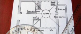
In addition to dividing the circle into four directions - north, south, west, east - as orientation problems developed, additional divisions with intermediate directions were introduced: northwest, northeast, southwest, southeast; There are now eight directions in total. Later, the following intermediate divisions were introduced: north-northwest, west-northwest, etc., bringing the number of directions to 16. After another division into intermediate directions, this process was completed with the introduction of 32 directions.
Symbol [edit | edit code ]
To designate the cardinal directions, 4 Latin letters are often used: N, S, E, W (which corresponds to the first letters of the names of the cardinal directions in English - North, South, East, West) or S, Yu, E, W (which corresponds to the first letters of the names of the cardinal directions in Russian - North, South, East, West).
In addition, in the history of Russian maritime navigation for a long time, the German names for the cardinal directions were most often used (they are also used to this day) - Nord, Süd, Ost, West (Nord, Süd, Ost, West).
This is most likely explained by the fact that in the Peter the Great era - the beginning of the 18th century, when the navy of the Russian Empire was being born, many terms in the Russian language came, as is known, from the Dutch language, and there the cardinal directions have the following names, which are largely consonant related German: N - noord (north), O - oost (ost), Z - zuid (south), W - west (west).
How to navigate by shadow
You can also navigate and determine the position of the east by the shadow. To do this you need:
- Stick a peg or stick into the ground so that it protrudes 1 meter above the ground.
- Mark the end point of the cast shadow and note the time.
- After 15 minutes, mark another end point of the cast shadow.
- Draw a straight line through these two points, the first point will indicate the direction of the west, the second will show where the east is, the south will be in front of you, and opposite it will be the north.
West, east, north, south on the map
The emergence of geodesy goes back to the first trading civilizations of the East and West. They appeared quite a long time ago, and the closest known to us are the Sumerians and Egyptians.
There were two options for descriptions: global and local. The former rather depicted the general political mood and served to facilitate geopolitical orientation. Some presented more of an artistic explanation of culture, cities and language. Thus, anyone could understand who his neighbors in the state are, where it is dangerous to lay a path, where it is better to transport this or that cargo. This could be understood from the descriptions on the site plans, with notes about the resources that a certain region is rich in. The location of the cardinal points on a map of this type did not play a serious role, and was rather decorative (Figure 1).
Figure 1. Ancient maps were not very accurate
The second type is local plans used on fixed sections of the route (10-1000 km). They were already used for a narrower profile by sailors, trade caravans and military units, as well as travelers and pilgrims. Their main advantage was the determination of cardinal directions on the map using a compass sweep and/or directions pre-specified on paper. Since they were not drawn in absolute values, the drawing did not always correspond to the real location of the objects. By applying a compass, the cardinal directions on the map became clear, and one could tell how the plan was drawn and where a certain object was located. Engineers and experienced travelers were involved in drawing such complex drawings. They were required to have personal experience or huge amounts of data, so this occupation was considered prestigious and highly paid.
Determining where east is based on the location of the North Star
From school geography we know that the North Star is located near the North Pole. This is the brightest star in the European sky and is located in the constellation Ursa Minor, at the very end of its tail. It has long served as a landmark for sailors and travelers. Using it you can easily determine where the North is. As the night progresses, her position remains unchanged.
By facing it, we will determine where the east is. It will be on our right side. It should be taken into account that the difference between the true position of the north and the North Star is one degree. But this is not a big mistake for an ordinary person. The star got its name due to the fact that it points to the North Pole. There is no such star in the southern hemisphere.
Where is north, south, west and east on the map
Generally accepted standards and norms introduced during the era of industrialization also imply accurate drawings. All designations of cities, resources, terrain and roads must be equally clear and readable. The north, south, west and east on the map should correspond to the physical shape of the sheet. Namely, north is above, south is below, west is on the left, east is on the right (Figure 3).
Figure 3. Modern maps usually indicate cardinal directions
A card with orientation to the cardinal directions will be a good addition to your travel kit. Despite its apparent physical vulnerability, the paper counterpart is quite durable. A Google map with cardinal directions online will not be able to help in conditions where there is no way to charge the device, and you need to cover more than one kilometer. The exception will be incorrect types of layouts, where on the map north, south, west and east are located differently than on the standard layout.
Near East
The word “east” is used as a contrast to the countries of Western Europe. From a geographical point of view, countries belonging to the Middle East are not located in the East in relation to Europe.
The historical name of the Middle East is given to a large region of Asia and North Africa. It includes 17 countries inhabited by Armenians, Arabs, Turks, Kurds, Assyrians, Persians, Jews and other nationalities. For the most part, these are representatives of Islam, but there are also many Christians, Jews, Druze and Yazidis.
These areas are of strategic importance, as large hydrocarbon deposits are located here. The Middle East is a zone of constant military conflicts. This is a politically unstable area, since it is here that the Israeli-Palestinian conflict, the wars in Iraq and Syria are taking place, and the problematic Afghanistan is located. It is from the Middle East that Islamic extremism spreads.
How to determine cardinal directions on a map
Regardless of the purpose, the diagram contains data that will help you navigate it. Some samples have special star images that indicate with their rays where north, south, west and east are on the map.
The ends must go in the following order:
- The top one is North.
- The lowest one is South.
- Pointing to the right - East.
- Pointing left - West.
- The spaces between them will be labeled NW, SE, NE and SW.
By plants
How to navigate in the forest without a compass on a cloudy day? After all, it is possible to determine the sides of the horizon by the sun only in cloudless weather. In this case, you need to take a closer look at the trees. The following signs will help you navigate correctly:
- You will notice that one side of the bark is darker in color, and the other is lighter. This feature is most pronounced in coniferous trees. The dark bark is on the north side. Its color is due to less exposure to sunlight.
- It is also necessary to focus the removal on the resin of coniferous trees. Its greatest concentration is observed on the south side. And the growth of mosses, lichens and fungi on the bark is more often observed in the northern part.
In the summer, you can take a closer look at the color of the berries. They usually ripen faster on the south side. And the part of the berries that faces north has a greenish color.
How to determine cardinal directions on a Yandex map
The smartphone is a multifunctional tool of the new era. Its only drawback is its limited operating time without recharging. But even these capacities are quite enough for short-term orientation sessions.
Figure 5. Yandex maps help you quickly navigate the area
How to determine cardinal directions on a Yandex map? Make sure the landscape image is static and not rotating. In the case when you do not notice movement and the image is static, then north will be at the top (Figure 5).
There is also an alternative way:
- To do this, you need to use the built-in feature of the Yandex application - Compass.
- Enable two-finger rotation in Settings.
- This will activate the appearance of a compass icon, which, when clicked, will orient you north-south.
- Now the north, south, west and east are positioned correctly on the map, and the top part will point to the Earth's magnetic pole.
compass needle
The needle is the main element of any magnetic compass, although there are models in which the needle forms one whole with a disk on which a scale is applied.
The arrow always turns along the Earth's magnetic field lines, which means it shows the approximate direction to the Earth's poles. While one end of the arrow points north, the other end will point south.
In the literature you can find information that the red end of the arrow points to the north, but this is not always the case. The manufacturer decides what color to paint the northern part of the needle, and this often does not coincide with what is written in various sources. In addition, sometimes the arrow is painted in colors that do not include red, for example, blue, white, black or even green.
One of the simple ways to figure out which part of the arrow is north, that is, points to the north, is to go outside with a compass at lunchtime in clear weather. The order of further actions is as follows:
- See which side the Sun is on. At this time, the star is located close to the south direction.
- Take the compass in your hand and place it in a horizontal position with the arrow pointing upward.
- If the compass is equipped with a locking lever, then “disable” it: the needle should be able to rotate freely on the pin. After this, the arrow will be positioned in the north-south direction.
- Determine the northern and southern parts of the arrow: the end of the arrow that will be directed towards the Sun will be southern, and the opposite end will be northern.
It should be noted that this rule is indicated for the countries of the former CIS; in the tropics and in the southern hemisphere it may not work due to the fact that the Sun at noon may be in this area not in the south, but in the north. This is important to consider in order to avoid mistakes.
There is another method, but it is more complex, although it allows you to determine the northern direction in both the northern and southern hemispheres at any latitude. To do this, in the morning - around 6 am - you need to stand so that the Sun is on the right. In this case, the north will be in the face of the person conducting the experiment. Accordingly, the part of the compass needle pointing “forward” will be north.
Now that you have managed to determine the sides of the arrow, you can use a compass to determine the location of the cardinal points. For this:
- The compass is taken in the hand and placed horizontally.
- The arrester, if provided in the design, is disabled to allow the needle to rotate and indicate the direction of north and south.
- The north direction is determined by the arrow readings.
- The person faces north.
- All other cardinal directions are determined: south will be behind, east will be to the right, and west will be to the left.
When working with a compass, you should avoid the proximity of iron, steel and other objects that have a significant magnetic field (for example, knives, mobile phones, vehicles, railway tracks), as well as wires carrying electric current (for example, power lines) . All these objects can distort compass readings.
Map with orientation by cardinal directions online
Google Maps is a good software for viewing geographic locations and getting directions. They also take into account the time required to complete the distance, adjusted for speed. Planning a route is quite simple. In such a diagram, north will always be at the top, and if you rotate the image, the compass icon will point to north automatically.
Detailed instructions for navigating the terrain using a map and compass are shown in the video.
To come in
Far East of Russia
This region occupies 34% of the country's territory. It includes the Primorsky, Kamchatka and Khabarovsk territories, the Chukotka Autonomous Okrug, the Republic of Sakha-Yakutia, the Jewish Autonomous Region, the Amur, Magadan and Sakhalin regions.
The region of the Far East is predominantly mountainous and seismic. The Pacific coast is prone to cyclones and tsunamis. There are active volcanoes on the Kamchatka Peninsula, the most active of which is Klyuchevaya Sopka. This area is rich in mineral resources: gold, nickel, tin, mercury, manganese, tungsten, polymetallic ores, brown and hard coal, oil and gas. Mineral resources have been explored, but practically untouched.
The area is sparsely populated, with 7 million people living in a vast area larger than Western Europe. This is mainly due to inaccessibility. Development of the northern regions is currently not possible. Most of the Russian Far East belongs to the Far North regions.
What is this zone - what is it responsible for?
In the teachings of Feng Shui, the southeastern energy zone is responsible for money, wealth and everything connected with it. It is believed that the activation of the southeastern zone according to Feng Shui can increase the well-being of its owner many times over. The element Wood corresponds to the southeast, and the color of this zone is green in all its shades.
The season corresponding to this zone is late spring-early summer. It is best to start all new business projects at this time of year.
Time of day: from 10 to 12 hours. It is recommended to resolve the most important financial issues at this time of day.
Organs: bladder and liver. If the wealth sector in an apartment or house is neglected, this can lead to diseases of these organs.
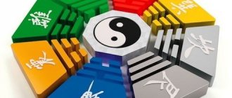
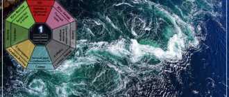
The trigram is Xun, consisting of two continuous Yang lines located above a broken Yin line.
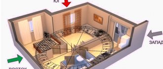
According to Feng Shui, any room - apartment, house or office - can be divided into 8 sectors, according to the cardinal directions. And not only the premises, but also any piece of land: a summer cottage, a personal plot, a site in front of an office or enterprise.
We have selected interesting articles for you:
Feng Shui zones in the apartment
27.01.2019
What is the glory zone responsible for in feng shui?
27.01.2019
Correct design and activation of the energy zone can change the aspect of human life for which this zone is responsible.
The southeastern part of the apartment or house is well suited for production and entrepreneurship. It is recommended to place your workplace or office in this area. Even if the work area cannot be placed in the southeast, make sure that the work table is oriented in this direction. This will help attract good luck in business.
The southeast is especially good for those involved in construction, gardening, cooking, fashion, advertising, woodworking, and media.
The office is the best room for the South-East zone.
However, the South-East zone does not have its influence on everyone:
- For people whose birth year ends in the number 8 or 9, the southeast sector has no effect. To improve their well-being, it is better for them to use the northeastern energy zone.
- For people whose birth year ends with the number 0, 1, 2 or 3, the southeast sector has a good influence.
- But the southeastern sector has the greatest influence on those whose year of birth ends with the number 4, 5, 6 or 7. For them, the southeastern zone is the happiest.
The southeast direction can even be used when applying for a job. It is believed that in order to successfully get a well-paid position, it is better to enter the building and office from the south-east direction. If this is not possible, mentally visualize a large compass near you, which shows that southeast is behind you. According to Feng Shui experts, this will provide additional energy opportunities for passing an interview.
When resolving financial issues or any conversation related to money, try to keep the southeast behind your back. This will help solve all money problems with maximum benefit. It is recommended to do the same when participating in a lottery, competitions with cash prizes, etc.
Methods for activating this zone
In order to activate the south-eastern zone of the room, it is necessary to decorate it accordingly and keep it tidy and clean.
The following Feng Shui symbols are well suited as a talisman:
- antique Chinese coins tied with a gold or black band;
- money or images of money;
- jewelry box;
- red mat, napkins or paper towels;
- oranges in the amount of 9 pieces.
If you plan to place furniture in the wealth zone, try to make sure that this furniture is made of wood. The best thing is rattan. When arranging furniture, avoid creating corners. Any corner is a place where positive energy stagnates, as it prevents its free circulation.
Keep it clean
Cleanliness and order in the energy zone of wealth is of great importance in order for it to be constantly activated. According to the teachings of Feng Shui, any dust, dirt, old and unnecessary things become clots of negative energy and interfere not only with proper circulation, but also with access to positive energy in the room.
To protect against dust and dirt in the welfare sector, lay down a red rug.
Color spectrum
The south-eastern sector of the apartment or even the entire apartment can be decorated in colors and shades that attract the energy of money. Favorable colors include the following colors of the east:
- green;
- blue;
- lilac;
- emerald;
- violet.
If possible, choose tall, oblong-shaped objects to decorate the energy zone.
Plants
Considering that the main element of the money zone is a tree, the best design for it would be living plants. They have a strong ability to attract money energy when they are in this sector. The strongest magnet for suitable energy is the money tree. You can buy it, but it’s best to grow it yourself by placing a coin at the bottom of the pot.
In China, Feng Shui followers, when starting a new business or project, plant a money tree and place a large coin at the bottom of the pot. This tree becomes a mascot for business: as the tree grows, so does the business. If a tree begins to wither or become sick, this is regarded as a signal that the business may be in danger.
Plants and flowers living in the money sector must be carefully taken care of. Regularly water, feed, wipe the leaves from dust. Sick plants have no place in the wealth sector - they will symbolize problems in cash flows. Therefore, diseased plants need to be urgently moved to another sector or disposed of.
Artificial plants have no place in the southeast zone. Only paintings and photographs with their images can replace living plants.
The Wood element does not combine well with the Metal element, so it is highly not recommended to keep metal objects in the southeastern sector unless they are money or figurines.
Water elements
Feng Shui advises placing an aquarium with nine fish in the wealth zone, of which 8 should be red and one should be black. Instead of an aquarium, you can put a fashionable artificial waterfall, a fountain, an air humidifier, a bowl of clean water and any other items closely related to this liquid.
If for some reason all this is difficult to implement, hang pictures depicting water: the ocean, sea, river, lake or waterfall. You can even hang up your own paintings or photographs of water.
If you are designing an outdoor area, you can arrange a pond with live carp in the southeast. Carp is also considered a symbol of wealth and monetary prosperity, so it will also attract financial well-being.
All water elements must be moving, not stagnant. You can install an aerator in the aquarium, which will create the effect of water movement, or install a spring in a pond on the site as a source of fresh water.
When arranging water elements, Feng Shui experts advise not to get too carried away. Firstly, if the element of Water is represented stronger than the element of Wood, the water will flood it and it will wither. Secondly, because Feng Shui still teaches harmony and balance.
Paintings
It is better to use as paintings those that depict the main element of the southeast - wood, and the main element - Water. All paintings with images of water and living plants will attract the energy of wealth and will serve as a good activator of the welfare sector.
Paintings depicting money, riches and treasures, red and gold tapestries and jewelry perform their role well.
You can also use paintings depicting the main supporting element of the southeast - the Earth. They can depict fields of grass or crops, landscapes, canyons, etc.
Figurines
In China, various figurines are used to activate the southeastern sector of the house, such as:
- three-legged toad with a coin in its mouth;
- laughing god Hottey or laughing Buddha;
- god Fu-Xing;
- figurine of a turtle;
- ship of abundance;
- any piggy bank with coins inside.
"The music of wind"
Wind chimes are sounds created by four hollow tubes suspended from the ceiling. Such music restores the free circulation of positive energy and makes the money zone fill with good energy.
